In today’s digital era, maps have evolved far beyond simple static images that provide geographical information. Propelled by the advances in technology, maps have morphed into interactive tools that can illustrate, guide, inform, and much more.
They have transcended their conventional form and transformed into dynamic platforms that respond to user behavior, offer real-time data, and cater to specific demands – these are none other than Interactive Maps.
As we traverse through this discussion, we’ll dive into the concept of interactive maps, their wide-ranging applications and use-cases, the steps involved in creating them, the challenges faced in their design, and the potential future of this cutting-edge technology.
Understanding Interactive Maps
Interactive Maps: Ascending to Relevance in Today’s Tech Era
Mapping technology, once limited to paper print or basic online digital representations, has been evolving at a striking pace, redefining our very understanding of geography and data interpretation. At the forefront of this ongoing revolution is one exciting element – Interactive Maps.
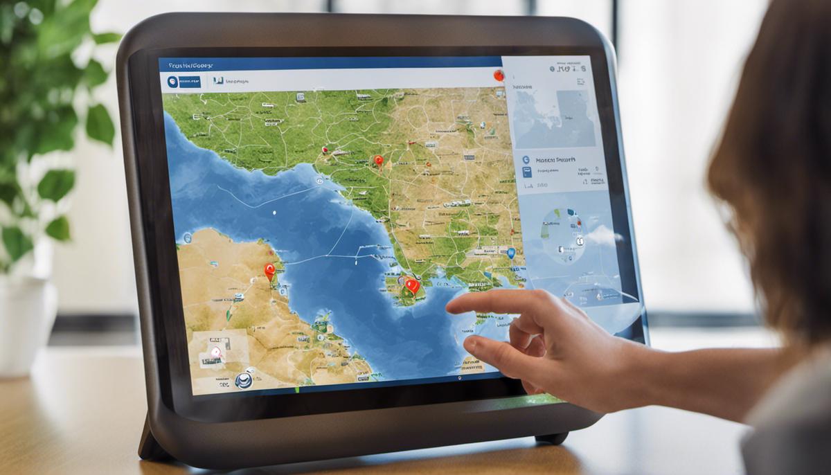
An interactive map is fundamentally a visual display of data designed to allow users to manipulate it, exploring various layers, zooming in and out of particular areas, or obtaining specific information about different locations by simply clicking on them. They bring together the strength of Geographic Information Systems (GIS), advanced computer graphics, and ubiquitous internet connectivity.
We live in an era where the ability to access real-world, data-driven insights in real-time is highly valued. On this forefront, interactive maps unveil the true potential of geographical data by offering an immersive, fully-responsive, and interactive experience. They allow users to engage with data on a more personal and intuitive level.
A key reason interactive maps are pivotal in today’s tech era is how they revolutionize the comprehensibility of complex data. They transform vast, intricate datasets into visually engaging and easily understandable formats. This directly addresses one of technology’s fundamental aims of simplifying complexities and improving human life in meaningful ways.
Another significant aspect is how interactive maps harness the power of visual representation to influence decision-making processes. They are invaluable tools in a variety of sectors, including urban planning, environmental conservation, military strategy, e-commerce, and even healthcare.
For instance, think about e-commerce giants who use interactive maps for logistical purposes. They can visualize customer distribution, identify optimal routes for delivery, and plan expansion strategies. Similarly, public health officials can use interactive maps to trace the spread of diseases, identify hotspots, and plan intervention measures quickly and efficiently.
Interactive maps also promote user engagement, particularly in educational settings. They invoke curiosity and stimulate learning. Students can explore historical events, cultural nuances, and geographical climates, enabling an immersive, exploratory approach to learning beyond the confines of a traditional classroom.
In a world driven by data, interactive maps serve as conduits, bridging the gap between raw data and its potential to drive real-world applications. They offer versatility, providing invaluable insights across a plethora of sectors. They permit synergy between the human ability to understand visual patterns and modern-day computing power’s capabilities in handling vast data sets.
In the current tech era, dominated by AI, Machine Learning, and Big Data, interactive maps undoubtedly play a unique and critical role. As technology progresses, they will continue to be instrumental in visualizing, analyzing, and understanding the world around us with unmatched detail and accuracy. Interactive maps, as these trends unfold, are assuredly more than just tools; they are transformative elements shaping the digital landscape.

Exploring Use-cases of Interactive Maps
Bringing the discussion deeper into the world of interactive mapping technology, it’s crucial to recognize the advanced applications made possible through this innovative feature. For instance, in the field of marketing and sales, companies are employing interactive maps to offer personalized customer experiences. Take Uber; their interactive map provides real-time location updates, an optimal transportation route, and estimated time of arrival – making for a seamless and customer-friendly service.
In the tourism industry, hotels, and tour operators regularly utilize interactive maps as part of their booking engines. Offering an immersive experience, users can ‘walk through’ their potential holiday and choose hotels or tourist destinations based on their location and proximity to local attractions. Simulations are also a rapidly expanding area where interactive maps shine. Military training programs use interactive maps to create immersive and realistic training environments, enhancing preparedness and strategic planning.
Considering the education sector, traditional, one-dimensional maps are replaced by interactive ones, taking geographic learning to a whole new level. These maps not only show locations but also offer additional layers of information like climate, demographics, and history. Students can ‘travel’ around the world, unraveling different layers of knowledge with each click.
In the field of disaster management, interactive maps have proven their worth time and again. Rescuers can predict disaster paths, strategize foresights, and plan evacuations more effectively. Non-profit organizations like Red Cross and United Nations have integrated interactive maps in their disaster relief schemes, leading to more efficient and timely interventions.
As the world moves forward in AI and Big Data, ‘Geoparsing’ and ‘Geocoding’ are changing the game in eCommerce. With the ability to predict buying behavior based on geographical demographics and accurate real-time positioning, interactive maps are paving the way for new marketing strategies and sustainable growth.
Furthermore, environmentalists utilize interactive mapping applications to monitor deforestation, climate changes, and wildlife movement. Such concrete data representation facilitates better comprehension of these complex issues, enabling evidence-based policymaking.
In a world increasingly dominated by digitization and data-driven decision making, interactive maps are not just optional tools but elemental in optimizing performance across various sectors. The revolution has surfaced beyond providing mere location data. Interactive maps now translate complex data into tangible insights, shaping strategic decisions and forecast trends. They have indeed ushered a new era in technology where graphic visualization intertwines with analytical data, creating an experience that is not only interactive but also informative and innovative. The integration of this tool is expected to continually rise, pushing the boundaries for industries to uncover the full potential of location data and interactive experiences. It’s clear to see that interactive maps are not just the present, but the future of tech-savvy problem solving.

Implementing Interactive Maps
Now that we have dissected the gamut of interactive mapping, its potential, and pervasive use across several sectors, let’s delve into the practical aspect – the creation of an interactive map. There are three fundamental steps to contemplate: Data Collection, Data Processing, and User Interaction Design.
Data Collection
Data Collection is the foundation upon which interactive maps are built. Clear, precise, and accurate data acquisition is paramount. Data can be gathered from diverse sources such as field surveys, remote sensing, and digital databases. Spatial, demographic, and statistical data types are among the vital fuel sources that power the mapping engine. The choice of data for collection is majorly dependent on the end goal of the map. For example, creating a map for environmental conservation would require a collection of wildlife patterns, weather updates, vegetation data, and geographical data.
Data Processing
Next, Data Processing plays a pivotal role in transforming the raw, unprocessed data into meaningful information. It’s in this phase that Geocoding and Geoparsing come into play, changing raw data into visual, identifiable elements on the map. Machine Learning and AI tools have shown substantial growth in refining this very domain. They help in cleaning, normalizing, and organizing disparate data sets, making them easier to analyze and interpret. With Big Data and advanced computing power, maps can process multifaceted data at a lightning-fast pace and with high precision.
User Interaction Design
Lastly, the design of User Interaction in interactive maps is what sets it apart. The human side of the equation can’t be overlooked. After all, maps are being designed for users to engage, understand, and interact with. The experience should be seamless, intuitive, and enriching for the user. Therefore, it’s critical to align the design of the tool to the audience it’s intended for. The layout, graphics, colors, controls, and even the placement of different components impact the overall user experience. User feedback is a valuable tool that can guide the evolution of interactive map interfaces, improving user engagement and satisfaction.
It wouldn’t be an overstatement to say that interactive maps are far from touching their zenith, especially when we integrate them with other tech trends like Augmented Reality (AR), Virtual Reality (VR), and Internet of Things (IoT). The possibilities are boundless, from 3D virtual tours in real estate to predicting traffic jams and offering optimal routes in real time. The amalgamation of these transformative technologies with interactive maps can create unprecedented solutions, completely redefining how we perceive and interact with the world around us.
Together, these three aspects—data collection, data processing, and user interaction—paint a full picture of what it takes to create an interactive map. In the end, the intention is to unleash the true potential of spatial data, transcending beyond the limitations of traditional mapping to create a tool that is dynamic, engaging, and insightful. The bottom line is that an interactive map is as good as the data it’s built upon and the design making it utilizable. The era of interactive mapping has just begun and is pregnant with unexplored opportunities, ready for tech aficionados to take up the challenge.

Challenges and Solutions in Interactive Map Design
While the insights and potential applications of interactive maps arise from the seamless fusion of technology, human understanding, and raw data, the crafting of these dynamic tools is often fraught with challenges. Various obstacles arise in designing interactive maps that are user-friendly, engaging, and reliable. Crucial to overcoming these roadblocks, is understanding their nature and concocting appropriate solutions.
One significant challenge faced by interactive map designers pertains to the diversity of user-interfaces. As interactive maps are employed across multiple sectors and devices—ranging from mobile and desktop platforms to AR and VR equipment—designing a universally engaging and functional user-interface proves daunting. The solution lies in the adoption of responsive design principles to ensure map accessibility and usability across different platforms.
The varied levels of user digital literacy also pose a challenge. Simplifying the interaction process to cater to all user abilities, without compromising the richness of data, proves to be a tough balancing act. The key is to opt for intuitive designs and user-friendly tools, thereby simplifying complex data interaction processes. Providing ample instructions, user guides, or tutorials can further drive user inclusivity.
Presenting and managing a large volume of data efficiently is yet another challenge. The dynamic nature of interactive maps demands high levels of data accuracy, timeliness, and relevancy. Real-time updates, information verification, and the ability to handle heavy traffic are crucial elements to consider. Leveraging cloud computing and optimizing data through technologies such as AI and Machine Learning could offer potential solutions.
Privacy and security concerns in data handling add another layer of complexity to the design of interactive maps. Ensuring data integrity and the privacy of users’ location information is indispensable. Implementing robust security protocols, encryption methodologies, and stringent data policies can help alleviate such concerns.
The challenge of cross-cultural and cross-geographic compatibility in interactive map designs is also noteworthy. Maps should effectively cater to users from different cultural backgrounds and geographical locations. Attention should be vested in the correct depiction of locations, sensitivity to local customs, and the inclusion of multiple languages where appropriate.
Lastly, the ever-evolving technology landscape requires the constant updating and adaptation of interactive map designs. Emerging technologies like 5G connectivity, AI, Machine Learning, and IoT require designers to continuously innovate and remodel their designs to ride the wave of tech trends, enhancing effectiveness.
Indeed, designing interactive maps is a craft cobwebbed with challenges. But with a keen understanding of these obstacles and informed solutions, the potentials are transformative. The role of interactive maps in our digital age is undeniable, and overcoming their design challenges is crucial in driving towards technological advancement. Realizing the full potential of interactive maps would revolutionize how humans understand and interact with the world, bridging the gap between what is and what can be.

Photo by tamas_tuzeskatai on Unsplash
Forecasting the Future of Interactive Maps
Subsequent to the key utility and transformative elements of interactive maps being covered, it’s crucial to highlight the ongoing efforts towards improved user personalization and individual engagement.
One of the breakthrough innovations is the idea of ‘self-learning’ interactive maps, powered by Artificial Intelligence algorithms that get smarter with each user interaction.
The trend of smarter mapping applications adapts on the fly, learning user patterns and preferences to streamline suggestions and route planning. This self-learning nature is not just confined to route suggestions but also extends to predicting possible areas of interest, improving overall user experience. These real-time personalizations are a significant step forward in mapping technology, transcending it from merely factual to highly intuitive and user-sensitive.
However, as interactive maps and location-based services become increasingly predictive, privacy implications too escalate. Stringent data protection laws, anonymization methods, and rigorous consent mechanisms are coming into play to safeguard users’ sensitive information. The tech forefront is witnessing the induction of blockchain technologies to ensure data transparency and user control over personal data.
Moreover, the future of interactive maps is also looking towards heightening immersive user experiences. The seamless blending of interactive maps with Augmented Reality (AR) and Virtual Reality (VR) technologies is opening up an exciting world of possibilities. Imagine strolling through a digital representation of a city’s street before actually visiting it, or visualizing how a piece of furniture would look in your house through AR-powered apps with embedded interactive maps.
Additionally, the Internet of Things (IoT) amalgamation with interactive mapping has a promising future. Connected devices provide real-time reporting monitored and controlled through interactive maps for more efficient systems management, for instance, smart cities with traffic and energy systems being optimized in real time based on analyzed trends and patterns.
But, with all these advancements, one cannot overlook the challenges lining this path. Addressing the varying levels of digital literacy amongst users and creating intuitive and user-friendly interfaces are the immediate hurdles. Alongside, cross-geographical and cross-cultural compatibility issues also take precedence as companies aim for global reach.
Moreover, the matter of constant technological adaptation quivers the landscape. As tech advances at lightning speed, iterative updating and evolving of interactive maps to integrate the latest technological breakthroughs is critical for their continued relevance and user acceptance.
Therefore, in the light of the points illustrated, the future of interactive maps is nothing short of transformative. Beyond just information presentation, interactive maps are key in shaping a series of converging technologies like AI, AR/VR, IoT, and blockchain. They stand as a testament to the enormous potential hidden in amalgamating geospatial data with cutting-edge technology, offering tailored, engaging, and immersive experiences that shape numerous paths for future tech innovations.

Navigating through the multi-faceted world of interactive maps, it is clear that they are not just a technological innovation, but also a medium enhancing decision-making, transforming industries, and reshaping how we interpret and interact with our world. Their scope of influence is set to grow broader as we foresee the integration of AI, augmented reality and countless further advancements. As these maps continue to break boundaries, their evolution will undoubtedly parallel the trajectory of technological progress, promising a future which is not just more connected, but also more intuitive, efficient, and dynamic. The journey of understanding interactive maps is indeed a window into the future, one where we embrace technology as an extension and enrichment of our human capabilities.

